30 Nov 2010

Puncak Suroloyo, Where The King Did Penance Knights


Four big mountain on the island of Java, namely Merapi, Merbabu, Cleft and Sindoro poking among white mist. The thickness of the white mist that looks like the waves that drown the mainland until the only remaining fields that make up the composition of the tread siring and trees located on higher ground. From behind the white mist of that, the top of the stupa of Borobudur temple which appear black appears on the surface of the ocean mist.

The sun appears reddish in color at about 5:00 pm, poking among the twigs of trees are green. Its rays made the heavens are divided into three main colors, blue, orange and yellow. In unison when the color of the sky began to split, a group of black birds began to enliven the space and create an original sound soil insects slowly melirih tight.

That's the scenery that can be seen at dawn while standing at the top Suroloyo, the highest in the Mountains Menoreh buykit which is at 1091 meters above sea level. To enjoy it, you must pass through a sharp detour and a fairly steep incline menakhlukkan, and start the journey at least at 2 o'clock in the morning. Two paths to choose from, the first route Godean Road - Sentolo - Kalibawang and the second route Magelang Street - Market Muntilan - Kalibawang. The first route was chosen both because it will bring you more quickly. Of course you must be in excellent physical condition, as well as vehicle fuel must contain full and if necessary carry spare tires.


After walking about 40 km, you will see signposts toward Sendang Sono. You can turn left to go to the Peak Suroloyo, but it is recommended you go on first as far as 500 meters to meet with a small T-junction and turn left because the road is more subtle. From there, you still have to climb another 15 km to reach the Peak Suroloyo. An exhausting trip indeed, but it paid off with beautiful scenery that can be seen.
 
Signs you've reached the hill Suroloyo is indicated by three substations of view which is also known as the hermitage, each named Suroloyo, Sariloyo and Kaendran. Suroloyo is the hermitage of the first encountered, can be reached by walking up the stairs with a slope of 286 children 300 - 600. From the top, you can see more clearly the Borobudur Temple, Mount Merapi and Merbabu, and the views of the city of Magelang when the fog did not cover.


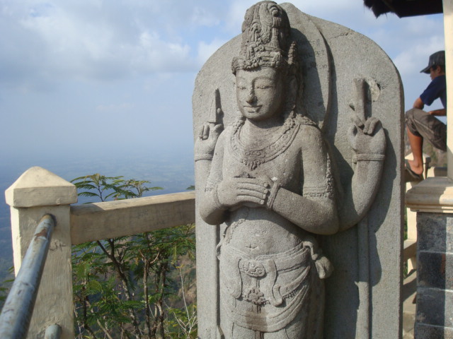
Suroloyo Hermitage is the most legendary. According to the story, in this hermitage Raden Mas stimuli that then the title of Sultan Agung Hanyokrokusumo be imprisoned for running wangsit who came to him. In the book Cabolek Yosodipuro Ngabehi works written in the 18th century, Sultan Agung had two wangsit, first that he would become ruler of the land of Java so that pushed him to walk toward the west until he came Mountains Kotagede Menoreh second that he should do Tapa Kesatrian order to become ruler.

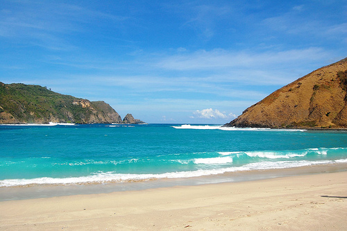
Towards another hermitage, you will see different scenery. At the peak Sariloyo which is located 200 meters west of the hermitage Suroloyo, you will see Sindoro Sumbing and more clearly. Before reaching the hermitage that, you can see the monument boundary with the province of Yogyakarta in Central Java who was standing on flat ground Tegal Overheated. From the hermitage Sariloyo, if you walk 250 meters and up to the hermitage Kaendran, you will be able to see the sights of the city and the beauty of Kulon Progo panati Glagah.

After seeing sights in the third monastery, you can walk around the Peak Suroloyo and see the activities of residents in the morning. Usually, starting around 5 am residents had already left field while smoking hand-rolled. When you walk near the residents, the delicious aroma of incense will greet the senses of smell because most men who smoked hand-rolled tobacco mix with incense for the tasty aroma.


Besides having an amazing scenery, the Peak Suroloyo also save myth. The peak is believed to be the mecca pancering earth (center of the four corners) in the land of Java. Local people believe that this peak is the confluence of two lines drawn from north to south and from west to east Java. With myth, history and its natural scenery, of course is the perfect place to visit on the first day in the new year.


Borobudur From Past To Future, Everything About Life


This Buddhist temple has 1460 relief panels and 504 Buddha effigies in the complex. Millions of people are yearning to visit the buildings included in this World Wonder Heritages. No wonder, for the architectural and function as a place of worship, Borobudur is attractive heart.

Borobudur was built by King Samaratungga, one of the kings of Old Mataram Kingdom, Dynasty descendant dynasty. Based Kayumwungan inscription, an Indonesian named Hudaya Kandahjaya revealed that Borobudur is a place of worship was completed on 26 May 824, almost a hundred years from the time the construction. The name of Borobudur, as some people means a mountain having terraces (budhara), while the other says that Borobudur means monastery on the high ground.

From The Summit Of Mount Lemongan This, I See Mountains In The Past.


Lamongan Mountain complex is located between two giant volcanoes, namely Mount Tengger complex on the west and east of Mount Iyang. Mount Lamongan classified as one of the 21 volcanoes in Indonesia are classified as class A, that the mountains are at least experienced eruption (eruption) magnetic one time since 1600. Noted this mountain had erupted in 1799. Even until 1898, the mountain was once held the record for the largest eruption in Indonesia. Since the 1900's, Mount Lamongan never erupt again. Finally, the record was taken over by the eruption of Mount Semeru.

This mountain actually has its own uniqueness that is rarely held by other mountains on the island of Java. If we climb up to its peak, there is a very stunning scenery. Apart from Mount Semeru in the distance, we will also see the tectonic lakes at the foot of Mount Lamongan. From its peak, the lakes that look like small pools that dot.

In terms of geology and volcanology, tectonic lake is known as a maar. Maar volcanic eruption caused a steep-walled circular. Maar formed by the eruption freatik and enterprising freatomagnetik in one period. Since 1907 to now there are only 10 pieces maar formed in the earth. However, in prehistoric times has formed many maar.

Route starts from heading to Klakah before the City Lumajang with the bus fare of Rp. 10.000, - per person. From Klakah climbers begin ascent to the top of the mountain. Prior to the summit we rest on the Village Papringan (source water) to fill the water supply to meet demand until the puncak.perjalanan from Klakah until Village Papringan usually takes about 1 hour. From Papringan we headed to the caretaker's house Mount Lamongan namely Mbah Citro. Climbing to Grandma's house Citro takes 1 hour. Here we can rest to recover stamina. Climbing to the peak is better done at night.

Around 22:00 pm we can start climbing towards the summit. Climbing evening is intended to relieve the heat and thirst. Around 23:00 climbers arrive at Watu Gede with sloping road conditions. In Watu Gede climbers usually take a rest for 2 hours. Exactly at 01.00 climbers start climbing back up to the puncak.pendaki will reach a rather steep road. So the climbers to be extra careful, because the rocky road.

Once past the steep hill we can find a fern forest, then we will arrive at Alas Kobong and through steep climbs. Approximately 50 meters we can reach the top. At our peak until around 05.00 and can enjoy the sun rise and the beauty of Mount Raung, Argopuro, mountainous Tengger Semeru. Total ascent can be achieved 1 day.
 

Pura Giri Selaka and Purwo Alas, Mysticism The Dazzle


Majapahit kingdom collapsed when the 14th century, the royal manggala saying, "It's okay to their kingdom was destroyed, but wait five hundred years their descendants will rise up and charge back the former territory of Majapahit." That's what most Hindus believe Banyuwangi, so that now there is pride for them to return to Hinduism. That spirit that accompanied the implementation of the Pura Giri piodalan Selaka, Purwo Alas, the day Pagerwesi, Wednesday (11 / 9). What is the condition of Hindus in the vicinity of Ala Purwo today? What problems faced by Hindus in there to go back to the identity as a Hindu?

Hearing the name Purwo Alas, the imagination of people would be drawn to an area of dense forest. It was true, Alas Purwo is a forest park under the scope of the Department of Forestry and Plantations. Then what is the relationship between Pura Giri Selaka and Purwo Alas it?
That is a phenomenon that seems to accompany the existence of almost all historic temple, not only in Bali but also in Java. To reach the disungsung Pura Alas Purwo Hindus Tegaldlimo District, Banyuwangi, the pemedek must enter the forest area of National Park Alas Purwo. From the front door of the National Park forest area, it takes one hour to the Pura Giri Selaka with road conditions are not yet paved.
 
On both sides we just lined teak forests, and the number of people passing by can be counted on the fingers. For pemedek that do not use private vehicles, local communities prepare a traditional transportation commonly known grandong. Is similar to a car transport truck, but the engine using the engine generator. The rent to Pura Giri Selaka around Rp 2,500 per one transportation.

To find Pura Giri Selaka, it must be ready to put questions to the people along the journey. If not, do not expect the journey can be smooth, let alone just once or twice to the destination. The reason, many branch roads without customer name Purwo Alas, so a trip from Bali to the Alas Purwo can we take 90-10 hours with such conditions.


Pura Giri Selaka surrounded by a forest and about three kilometer beach is a tourist area Plengkung, lips Alas Purwo itself. In this area, there is no one home residents. If you want to spend the night, the manager of Park provides a number of simple inn, located about one kilometer from the temple Giri Selaka. Although the available number of lodging, it seems that pemedek who want to Pura Giri Tangkil Selaka prefer makemit in the temple area. Moreover, the temple area has now reached the area of two hectares of Forestry as a result of the Minister responsible for National Parks concerned.


According to Hindu elders Tegaldlimo, Stakeholder Ali Wahono, Pura Giri Selaka actually discovered by accident by people around him in 1967. At that time, people do perabasan Tegaldlimo District against a number of forest areas for cultivation Purwo Alas. The area around the temple also appears to be quite prosperous with palawijanya results. One time, in place of the founding of Pura Alas Purwo a community called Site Purwo Alas, there is a mound of dirt.


The public wants to flatten and make the land suitable planting. Unexpectedly, there is a large brick bungkahan-bungkahan still stacked. Just like a small gate. Then the surrounding community to bring bungkahan bricks into the house. There are ingredients that make a kitchen stove, there is also to create a home base. Apparently, the innocence of society that have resulted in disaster for the people who take these bricks.


A few moments after taking the brick, all of them fell ill. At that moment, there is the word for chunks of brick is restored to its original place. Lumps that is where petapakan Hindu holy sages of antiquity. Although no official records of inscriptions, public trust in sites that malinggih Pura Alas Purwo is professor Bharadah. However, there is also a mention Rsi Markandiya before their way to Bali. Furthermore, local people are very confident with the strength and sanctity of these sites Purwo Alas. Until there is a citizen wishes to fence off the site was safe from the reach of the ignorant. However, not until thoroughly fulfill his desire, residents passed away. Of the incident found the word, if the site is obligatory Alas Purwo revered of all human beings on this earth without being restricted class barriers.   

Dense Smoke, But Peaceful When Looking At Ijen Crater


This crater has an area of about 5466 hectares. Water crater was quite calm and bluish green. The scene there looks so amazing in the morning. Water crater volume of about 200 million cubic meters to reach 200 degrees Celsius heat it emits a golden glow green when the sunlight hits the back of Mount Merapi, the twin brother of Mount Ijen.

Ijen Crater Tourism Area is situated in the middle area of nature reserves included in the crater area regency, District Klobang and Banyuwangi, District slippery. This crater is a green lake tosca arriving at an altitude of 2368 meters above sea level. Caldera crater walls as high as 300-500m. Ijen lake has zero degrees of acidity, has a depth of 200 meters. Acidity is strong enough to dissolve the clothing and the human finger.


If the passing route of Bondowoso, in the course of going through the restricted zone of coffee plantation area which has three different gates. At each gate, visitors will be asked to sign the guest book and write the purpose of his trip. The view area is very attractive with a carpet of green coffee plantations arabikanya regularly, then afterwards there's pine forest and virgin forest also Ijen-Merapi Nature Reserve which is so dense.

To reach this area there are two ways, first through Banyuwangi town 38 km to the west through the slippery-Guava-Paltuding. The second way is through the town eastwards Bondowoso through Wonosari-Sempol-Paltuding far as 70 km. But although much of this second way is the most preferred by visitors because the road is paved smooth. While the route through Banyuwangi still a macadam road with a fairly steep incline.

Travel tour to the crater Ijen, starting from Paltuding which is an outpost at the foot of Mount Merapi-Ijen. From here there is a dirt road climb to an altitude of 2.400m and takes about 2 hours to walk leisurely. Arrive at the lip of the crater, stunning scenery will be presented in front of the eye. A green lake with a diameter of about 1 km is covered in mist and sulfur fumes were far below. From here visitors can see the miner-sulfur miners near the lake. To go to the lake, visitors must down the caldera cliff rocks along the path which is usually passed by the miners. Wet handkerchief is necessary here, because sometimes the wind carried the smoke to the path of decline.


In addition to the surface of the lake, visitors can also surround the caldera, which took less than a full day. Climbing to the crater is generally recommended starting in the morning. For security reasons, the climb to the crater of Paltuding closed after 14:00, because smoke and the possibility of wind direction that leads into the path of ascent. To pursue the journey in the morning, visitors are advised to stay at the nearby town of Bondowoso or Situbondo.    

3 Nov 2010

Curug Sembilan, Bengkulu (The Nine-Level Of Waterfall)

This tourist attraction located in the village of Padang Jaya, with the distance about 120 km from Airport Fatmawati, City of Bengkulu, Indonesia.
For tourists who want to enjoy the natural beauty around him.

This places, is located in the protected forest area is natural, ideal visited by tourists and nature lovers happy adventure in the wild. In the forest area around the waterfall, he said, there are many rare flora and fauna.

Level Nine waterfall is still one of mainstay attractions of North Bengkulu, Bengkulu province are much visited by tourists, both domestic and foreign. Sightseeing became one of the favorites of the tourists who visited Bengkulu, because of the unique and its uniqueness. From the name alone has a unique waterfall waterfall which has nine levels where each level to form its own waterfall is the one who became uniqueness of a waterfall iniyang not owned by another waterfall.

District Kerinci, Kerinci Mountain

Lake Kerinci which covers tens of hectares of cool air, each year become the location of the Community Care of Lake Kerinci Festival who has become an annual tourist calendar.
In the festival's various interesting tourist attractions and activities held in an effort to attract tourists to visit the Kerinci regency which is about 400 km from the city of Jambi's.
Lake Kerinci look so beautiful. In addition to its location at the foot of Mount King, this lake is located in two districts, namely the Lake District and District Round Lake Kerinci, Kerinci Regency.

Kerinci Lake has an area 4200 ha with a depth of 110 m and is situated at an altitude of 783 m above sea level. The lake holds many species of fish. Semah fish is kind of the most popular and also the endemic fish species. Besides the beautiful scenery, interaction with the community around the lake also present the impression for visitors, like the fishermen who catch fish by using traditional tools such as tangguk fishing rods, nets, nets, and fish trap. If lucky, when fishermen landed, visitors can buy fresh fish below the market price.
 In addition to the Lake Kerinci, there are other interesting tourist sites in the area:
- Regional Pesanggarahan, where we can see the view from the top of Lake Kerinci.
- Cape Hatta, Bung Hatta place to enjoy panoramic views of Lake Kerinci and plant trees there.
- House Laheik, a typical house in the village of Kerinci Seleman.
- Dolmen Stone Sacred Mosques King and Middle Island in Middle Island Village.
- All around the lake Kerinci there are also a number of carved stone megaliths alleged human heritage.

2 Nov 2010

Weh Island - Indonesia Corner


Weh Island, Sabang there are coral reefs, both hard corals and soft corals of all types, shapes and colors, all of which form a cluster of interesting reef to be enjoyed, among other areas of coral reefs with names lupas, rock deer, rock crackers.


In addition to coral reefs, Taman Wisata Alam Laut Pulau Weh, Sabang can find the kinds of reef fish such as Angel fish, fish Tropet, Dunsel fish, fish Sergeon, Grope fish, Parrot fish and others. These fish are around Weh Island Marine TWA and some are endemic in this region. In addition, many found the kinds of economic value such as tuna fish, Kakap, Grouper, Parrot, Banana-Pisangan and others.

Nature tourism activities that can be done in Weh Island is TWA Sea tourist activities such as surfing, boat, swimming, fishing, and diving under the water to enjoy nature with the diversity of coral reefs and reef fish are beautiful.

The Mentawai Island, Surfing to go..


The Mentawai Islands, roughly 100 km off of the west coast of Sumatra in Indonesia. They consist of 4 main islands with many smaller islands scattered throughout. From north to south, the main islands are Siberut, Sipora, North Pagi, and South Pagi.

There are four large Mentawai islands and many smaller islands scattered throughout. The most northerly is Siberut which contains an amazing area of world class in a five mile radius. Also to the North there are the Tellos Islands and the island of Nias.
 

These islands block most swells from reaching the mainland on Sumatra, but they offer some of the most perfect surf in the world. Access to the islands is by sea only with regular ferries to the main trading ports, but by far the best way to access the surf is by charter boat.

 
The Mentawais is the ultimate surf trip. The Mentawais are located some 130 km off the west coast of West Sumatra and the island chain offers some of the best surf to be found anywhere in the world.
The Mentawais receive large swells between the months of May and October with waves ranging up to fifteen feet. When the swells are large there is often the opportunity to surf smaller breaks. There are swells year round and always good waves to be found for all skill levels, from pro to amateur.
There is also good fishing, diving, and trekking.

Indonesia is one of the most consistent surf destinations in the world. The Mentawai islands block most swells from reaching the mainland on Sumatra, but they offer some of the most perfect surf in the world.

Lake Toba and Samosir Island

Samosir is a popular tourist destination due to the fantastic vistas it offers. The tourist resorts are concentrated in the Tuktuk area. The island is the centre of the Batak culture and many of this people’s artifacts remain on the island.


Samosir, is a large volcanic island in Lake Toba. Lake Toba is located in the north of the island of Sumatra in Indonesia.

The lake and island were formed after the eruption of a super volcano some 75 000 years ago. The island was originally connected to the surrounding caldera wall by a small isthmus, which was cut through to aid navigation.


At 630km², Samosir is also notable as being the largest island within an island, and the fourth largest lake island in the world.
Related Posts Plugin for WordPress, Blogger...